Our Battle Beneath the Surface- Milfoil
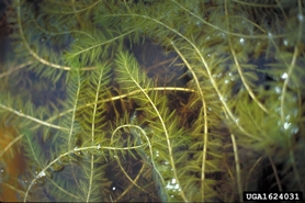
Eurasian watermilfoil is an invasive weed that grows in dense mats near the surface, crowding out native plants and making bays difficult to boat, swim or fish in. It is in Pelican Lake, it is not going away, and holding it back is the single largest thing the association spends money on.
Want to dig a little deeper? Learn more about Eurasian watermilfoil from the Wisconsin DNR.
What We Tried — and What We’re Doing Now
When Eurasian watermilfoil was first identified in Pelican Lake by the association’s lake consultant, Onterra, we started with chemical treatment. The first treatment covered 14.3 acres in Musky Bay, followed by a smaller treatment area the following year.
The treatments did what they were supposed to do—they knocked the milfoil back. But it eventually returned. That’s not unusual. Chemically treated milfoil commonly re-emerges within three to five years.
So, we’ve changed our approach.
Today, we focus on mechanical removal rather than chemical treatment, using two strategies:
Mechanical Harvesting
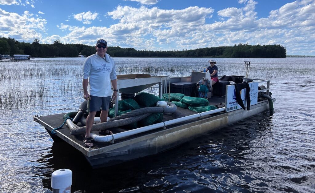
A harvesting boat cuts and collects milfoil across larger areas of the lake, opening up heavily affected bays and creating clear navigation lanes.
It’s a big job with a big impact, helping keep the lake accessible for boating, fishing, and swimming—especially when milfoil is at its worst later in the summer.
Diver-Assisted Suction Harvesting
Divers tackle small, newly discovered milfoil colonies by hand, pulling the plants roots and all and suctioning them to the surface.
It’s a slow and precise approach, but that’s exactly what makes it effective. By targeting new patches early, we can keep a small problem from turning into a much bigger one..
Neither method is about getting rid of milfoil completely—and that’s not a realistic goal. The goal is control. Keep the milfoil in check. Keep the lake usable. Give native plants room to thrive.
2025: The Numbers Behind the Work
| Sites mechanically harvested | 8 |
| Milfoil removed by harvesting | 3,425 cubic feet |
| Time on the water harvesting | 63.2 hours, between 30 June and 26 September |
| Priority sites worked by divers | 5 |
| Milfoil removed by divers | 303 cubic feet, across July |
2025: A Lighter Year for Milfoil
Milfoil was noticeably less widespread in 2025, especially in Outlet Bay. One likely reason was the higher, cloudier water, which meant less sunlight reached the plants and slowed their growth.
With less milfoil to remove, we didn’t need to use the entire harvesting budget. Instead of spending money just because it was budgeted, the remaining funds were carried forward to the following season.
One important thing to keep in mind when you see a weedy-looking bay: not every weed is milfoil. Musky Bay and Outlet Bay have always supported dense beds of native vegetation. Those native plants are a good thing—they’re an important part of a healthy lake ecosystem.
Keep the Next Invader Out

Milfoil arrived on a boat. So did the curly-leaf pondweed, rusty crayfish, and mystery snails already found in Pelican Lake. Zebra mussels could arrive the same way—and they’ve already been found on boats attempting to launch here.
The good news? Stopping an invasive species at the landing is far easier—and far less expensive—than trying to remove it once it’s established.
Through the Clean Boats, Clean Waters program, trained inspectors staff Pelican Lake’s boat landings throughout the season. In 2025, they inspected:
- 2,487 boats at the State Landing on County G
- 776 boats at Keeler’s Landing on County Q
- 33 boats at Musky Mart on Highway 45
Camera systems at two landings also record boat launches and retrievals. These systems are funded jointly by the Pelican Lake Association and the Towns of Enterprise and Schoepke.

Before You Leave the Landing
Wisconsin law requires every boater to inspect the boat and trailer, remove all plants and animals, drain all water, and never move live fish away from a water body. Inspectors are there to help and educate, but the rules are state law.
PLAW’s Lake Management Plan
Think of the Comprehensive Lake Management Plan as Pelican Lake’s roadmap for the next ten years.
Submitted to the DNR in 2025, the plan looks at the lake as a whole—including the watershed, aquatic plants, and fishery—and lays out a long-term strategy for protecting and managing Pelican Lake.
It’s more than just a plan on paper. It’s also the key to funding the work. The DNR requires current management plans and recent survey data to support many lake-management actions and grant applications. Keeping the plan up to date helps keep the association eligible for the grants that fund much of this work.
Mapping the Lake Bottom
Until recently, the only whole-lake survey of Pelican Lake was a hand-drawn DNR map from May 1940, with soundings taken every 250 feet.
In 2025, the membership voted to commission a modern, high-resolution survey of the entire lake. The project will produce three detailed maps showing water depth, vegetation density, and lake-bottom hardness.
Together, these maps will give the Pelican Lake Association something it has never had before: a detailed picture of what lies beneath the surface. This information will help guide buoy placement, aquatic plant management, fish habitat projects, and future grant applications. Just as importantly, the survey will establish a permanent baseline that can be used to track how Pelican Lake changes over time.
Survey Status
The survey is complete, and we’re now formatting the results for sharing and future use.
Once completed, the maps will be published here for members and the community to explore.
Who Pays for All This?
A lot of the work that keeps Pelican Lake healthy is grant-funded—and those grants exist because our members and volunteers put in the time to apply for them.
In 2025, the association secured:
- $45,303 in state Aquatic Invasive Species grant funding for mechanical harvesting
- $8,000 through the Clean Boats, Clean Waters program to support landing inspectors
- $7,000 from the Sokaogon Chippewa Community, supporting inspection and invasive species work
Grants help fund specific projects, but they don’t cover everything. Membership dues provide the foundation that makes the association’s work possible, including expenses grants won’t cover and the ability to commit to projects and prepare for the season before grant funding arrives.
Every membership, renewal, donation, and volunteer hour helps keep the work moving forward.
Want to help? Join or renew, or give directly to invasive species control.
The Dam & Lake Levels
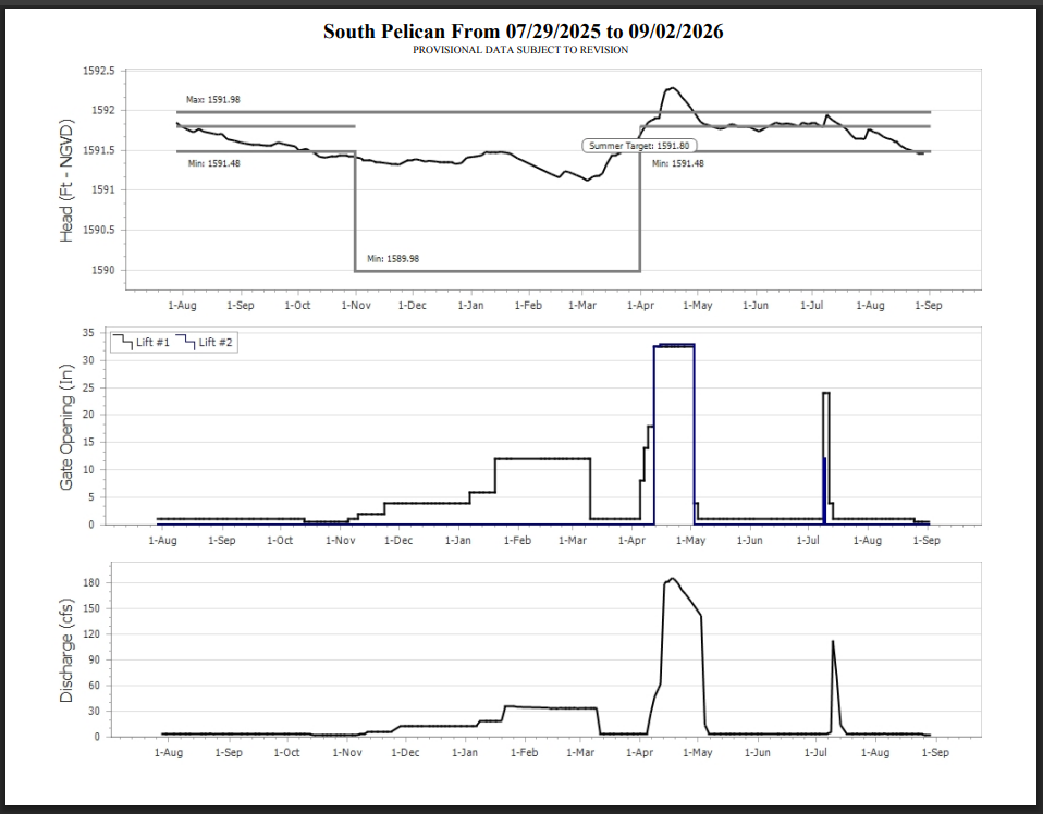
Pelican Lake is part of a series of reservoirs used to regulate flow on the Wisconsin River. The system is managed by the Wisconsin Valley Improvement Company under a federal license.
That is why Pelican Lake’s water levels can move in ways that aren’t explained by the weather alone. The lake is part of a managed system, not simply a lake that rises and falls with rainfall.
The federal license is currently under review, including issues related to shoreline erosion, fish and wildlife, land resources, and the operating plan for the Wisconsin River headwaters.
The Pelican Lake Association participates in this process and submits recommendations on behalf of its members, helping ensure that the interests of Pelican Lake and the people who live, work, and recreate here are represented.
Data published by the Wisconsin Valley Improvement Company. Readings are provisional and subject to revision. Check WVIC’s page for current operating notices, which may affect how the graph should be read.
More on Water Quality
Want to learn more about the work being done to protect and improve Pelican Lake? Here are some helpful places to start:
- Water Quality Committee — Learn who leads this work, when the committee meets, and how you can get involved.
- Water Quality News, Minutes & Events — Follow updates, meeting information, and events related to water quality.
- Boating Rules & Safety — Review boating guidelines, including information about the navigation lanes maintained through the weed beds.
- Have a question? Use the contact form and select “Water quality and invasive species.”
Figures on this page are from the 2025 season. Pelican Lake in Oneida County is DNR water body 1579900 — 3,545 acres, 16.3 miles of shoreline, 39 feet at its deepest.